While GPS, tracking collars and camera traps are routinely used in India to study animals in danger of extinction, the big cat is set to receive technical support. Every tiger has their own distinctive stripes, like fingerprints among human beings. Using these stripes, one can identify individual tigers and share information with conservationists studying them. Two major approaches are used for conserving threatened and endangered species. The first one protects the species within their natural habitat and the second includes caring and breeding them in an ex-situ environment. Using the technological approaches in captivity like breeding techniques and satellite imaging has a role in enhancing animal welfare and has contributed to spreading awareness. Some of the technology used are mentioned below.
Electronic smart collars - The smart collar is an electronic device consisting of GPS and an accelerometer to track the activities and location of the animals. These neckbands are placed around the neck of the animals. These smart collars tell the observer about every move of the animal. Due to these collars, forest authorities recognize the design of those living animal, they understand the behavior of the animal, animal responses to climatic changes etc. Due to these devices, their patterns are often mapped and therefore the animals are often saved during extreme climate conditions and save them from poachers.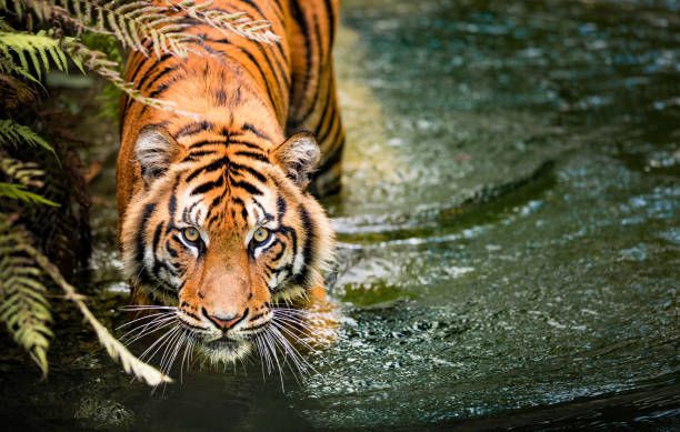
Remote control gadgets - To master the hunting habits, eating and sleeping habits of the animal remote control videography is utilized. Videography helps the authorities to urge close and record the small print about the animal which probably is difficult for humans to try to do by them. Nowadays all the wildlife conservation authorities use remote photography techniques to understand more about beings.
Satellite imaging and mapping - Development in India to satisfy the country's growing population needs and requirements was infringing on the fragile ecosystem that housed the tiger. Now an embracing of latest technology within the ongoing struggle to save lots of the tiger isn’t only mapping what percentage are left but also its habitat, helping to spot potential new homes.
- Project Tiger which is run by Indian wildlife and forest management officials aim to produce a 'tiger atlas' along with the 'tiger habitat population evaluation system'. Camera traps, Geographic Information Systems (GIS), satellite tracking and Combining radio telemetry can accurately estimate, track and protect India's remaining tigers. The Indian Institute of Science has made nearly 600 camera traps that are used by the forest departments, researchers and NGOs across the country. They are used to aid estimate population size. GIS is aimed to maneuver towards a day-to-day reporting of the animals within the field.
- The team is standing by to execute wireless sensor networks with the aim of active monitoring of tiger movements. Alongside this mapping, data acquisition, GIS modelling alongside field data collection and validation will help landscape the tiger's habitat. It will cover 17 states and conservation units including Shivalik-Terai covering protection units in the west ghat, east and the central India and North-East. Satellite data and classification information will help identify vegetation, map the land's contour, villages, roads, drainage and soil alongside agriculture requirements, the human population, livestock and meteorological conditions to monitor risks and characteristics. Technology is additionally targeting poachers through DNA analysis and wider communication is getting used to focus on crime.
- In India, the National Tiger Conservation Authority brought technology into the mix by launching projects such as ‘M-Stripes’ and ‘E-Eye’6. The M-Stripes system integrates ecological perception from tiger states with GIS tools to assess the intensity and spatial coverage of patrols by producing reports and maps that synthesize information on protection efforts, ecological status, illegal activities and wildlife crime. The ‘E-Eye’ on the opposite hand may be a pilot is being executed in Corbett Tiger Reserve that consists of inter-connected high-mounted short-range infra-red cameras that detect movement of anything above 20 Kilograms in a 300-square-mile radius. On detecting anomalies, it alerts the sector stations for appropriate action and has become a deterrent to poaching.
Emerging technologies like drones, remote cars, and visualization tools are helping humans to save lots of the species that have nearly become extinct. Science and technology have triggered a wide variety of gadgetry ideas to protect and observed wildlife species and protect them.

Author: Yukta Maurya: I'm a third-year student of Amity University enrolled in program B.Sc. Hons. Life Sciences. My friends would describe me as a fun loving and outgoing person. I like to reach out and help wherever I feel I can. I'm a nature enthusiast. I am creative and imaginative when it comes to my work, and I make sure I put my best foot forward with any task that I perform. I wish to pursue a career as a wildlife biologist.